arrow-right cart chevron-down chevron-left chevron-right chevron-up close menu minus play plus search share user email pinterest facebook instagram snapchat tumblr twitter vimeo youtube subscribe dogecoin dwolla forbrugsforeningen litecoin amazon_payments american_express bitcoin cirrus discover fancy interac jcb master paypal stripe visa diners_club dankort maestro trash

Shopping Cart


Shop All | Shop Maps
Click to close

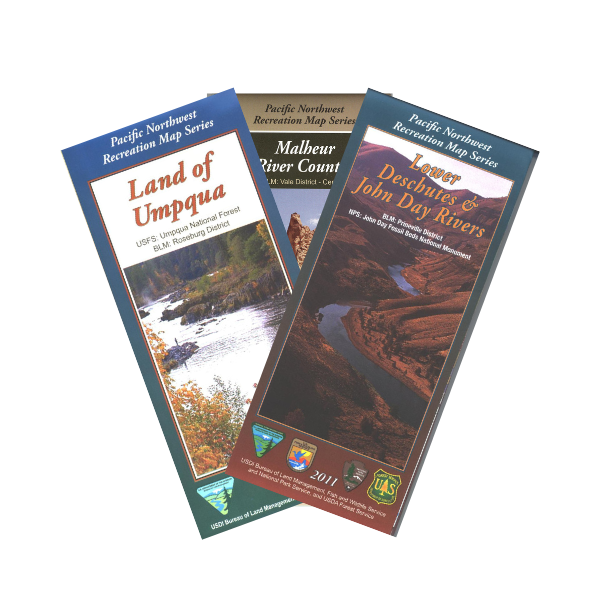
Pacific Northwest Recreation Map Series - Oregon

The Pacific Northwest Recreation Map Series is produced jointly by the DOI Bureau of Land Management and the USDA Forest Service for the states of Oregon and Washington. Recreational opportunities on US Fish & Wildlife Service and National Park Service land are also shown, as well as State and County sites, where applicable. Providing coverage at a scale of One-Half Inch = One Mile, and printed on a durable but biodegradable plastic/paper laminate, these maps are designed for use in the field, but fold down to 4x9 inches for easy packing. Thoroughly vetted by field personnel in all agencies, PNWRMS maps display a depth of information with a level of accuracy not found in other map products.

Pacific Northwest Recreation Map Series Oregon

Filter by

Availability
0 selected
Price
The highest price is $19.99
$
$
Filter and sort

Filter and sort

14 products


Availability

Availability

Price

Price

The highest price is $19.99

$
$
Map: Central Oregon Cascades OR - PNWRMS - 2020

Map: Central Oregon Cascades OR - PNWRMS - 2020

$19.99

/

Map: Columbia River Gorge National Scenic Area OR/WA - PNWRMS - 2020

Map: Columbia River Gorge National Scenic Area OR/WA - PNWRMS - 2020

$19.99

/

Map: Hart Mountain Country- PNWRMS - 2019

Map: Hart Mountain Country- PNWRMS - 2019

$19.99

/

Map: Land of Umpqua OR - PNWRMS - 2023

Map: Land of Umpqua OR - PNWRMS - 2023

$19.99

/

Map: Lower Deschutes & John Day Rivers OR - PNWRMS - 2019

Map: Lower Deschutes & John Day Rivers OR - PNWRMS - 2019

$19.99

/

Map: Malheur River Country OR - PNWRMS - 2015

Map: Malheur River Country OR - PNWRMS - 2015

$19.99

/

Map: Oregon Central Coast - PNWRMS - 2012

Map: Oregon Central Coast - PNWRMS - 2012

$19.99

/

Map: Oregon Outback - PNWRMS - 2016

Map: Oregon Outback - PNWRMS - 2016

Sold Out

/

Map: Owyhee Canyon Country OR - PNWRMS - 2023

Map: Owyhee Canyon Country OR - PNWRMS - 2023

$19.99

/

Map: Southern Blue Mountains OR - PNWRMS - 2018

Map: Southern Blue Mountains OR - PNWRMS - 2018

$19.99

/

Map: Steens High Desert Country OR - PNWRMS - 2014

Map: Steens High Desert Country OR - PNWRMS - 2014

$19.99

/

Map: Upper Klamath Basin Recreation OR - PNWRMS - 2006

Map: Upper Klamath Basin Recreation OR - PNWRMS - 2006

Sold Out

/

Map: Upper Rogue Basin OR - PNWRMS - 2021

Map: Upper Rogue Basin OR - PNWRMS - 2021

$19.99

/

Map: Willamette Cascades OR - PNWRMS - 2017

Map: Willamette Cascades OR - PNWRMS - 2017

$19.99

/

Thank you for shopping with us!

Every purchase through our online store aids our mission of educating and inspiring users of public lands. Through our educational programs, interpretive projects, and visitor services, we aim to make public lands accessible and understandable to all.